About Nauru
The Nauru flag represents the country's geographical position in the world. The blue field represent the surrounding Pacific Ocean and the clear blue sky. Nauru is located just south (26 miles) of the Equator (the bold yellow line), slightly west of the international dateline (the star is off centered towards the left of the flag). The 12 points on the star symbolize Nauru's 12 original tribes.
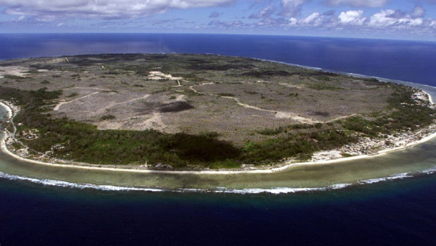
Nauru is the world's smallest Republic, covering just 21 square kilometres (8 sq mi), oval-shaped island in the southwestern Pacific Ocean, 42 kilometres (26 mi) south of the Equator, with just over 9,322 residents (estimate in July 2010). It is the second least-populated country after Vatican City. The island is surrounded by a coral reef, which is exposed at low tide and dotted with pinnacles. The reef is bounded seaward by deep water, and on the inside by a sandy beach.
• Full name: The Republic of Nauru
• Population: 9,322 (July 2010 estimate)
• Capital: no official capital; government offices in Yaren District
• Area: 21 sq km ( 8 sq miles)
• Major language: English, Nauruan (official, a distinct Pacific Island language)
• Life expectancy: 61 years (men), 68 years (women) (UN)
• Head of state: The president, who is also head of the government.
• Time zone: UTC+12
CQ Zone: 31
IOTA: OC-031
More detailed information available here.


